Text Products
Atlantic Tropical Weather Discussion
000
AXNT20 KNHC 041021
TWDAT

Tropical Weather Discussion
NWS National Hurricane Center Miami FL
1215 UTC Wed Nov 4 2026

Tropical Weather Discussion for North America, Central America
Gulf of America, Caribbean Sea, northern sections of South
America, and Atlantic Ocean to the African coast from the
Equator to 31N. The following information is based on satellite
imagery, weather observations, radar and meteorological analysis.

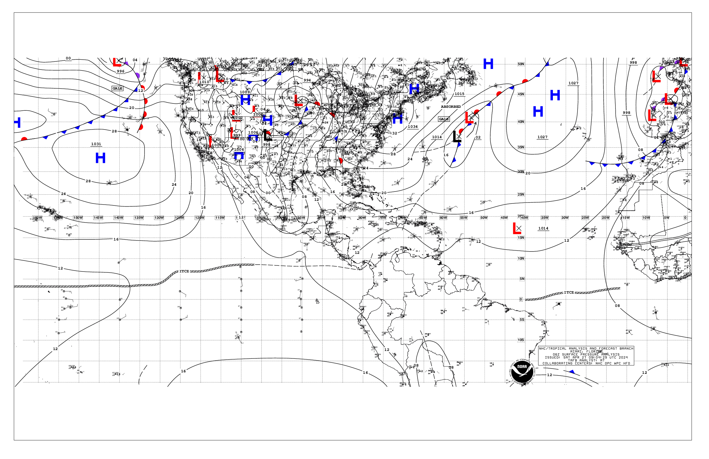
Based on 0600 UTC surface analysis and satellite imagery through
1000 UTC.

...SPECIAL FEATURES...

Western Atlantic Gale Warning: A sharp trough is analyzed this
evening from 26N65W to 22N68W. This development is associated
with an upper trough reaching from 32N70W through central Florida.
Recent buoy observations and scatterometer satellite data showed
fresh to strong NE to E winds between the trough and 1027 mb high
pressure over the western Atlantic near 37N65W. This pattern is
supporting a weak shear line along 25N. Concurrent altimeter data
showed 8-11 ft seas between the Bahamas and Bermuda. As the low
develops today, the pressure gradient is expected to yield near-
gale to gale-force NE to E winds beginning this afternoon,
roughly over the waters from 29N to 31N between 63W and 69W. Seas
are expected to build to 10-14 ft with these winds through Thu as
the low pressure drifts east-northeastward. The low pressure
could acquire some subtropical characteristics late this week as
it continues to shift slowly E-NE across the sub-tropical
Atlantic. Gale-force winds may continue across northern portions
of this expected broad low pressure into late Sat.

Please read the latest High Seas Forecast issued by the National
Hurricane Center at website: https://nhc.noaa.gov/text/HSFAT2.html

Heavy Precipitation across Central America: Deep-layer troughing
over the northwestern Caribbean will interact with enhanced low-
level moisture associated with broad cyclonic flow over the
western Caribbean during the next several days. This will favor
heavy precipitation developing across Central America, northern
South America, as well as Jamaica through Friday. The heaviest
precipitation is expected across southern and western portions of
Costa Rica, Panama, and Nicaragua, with the bulk of precipitation
occurring today through Thursday. Heavy rainfall will lead to
possible life-threatening flash flooding and landslides. Please
refer to your local weather agency and the International Desk at
the Weather Prediction Center for more details.

...MONSOON TROUGH/ITCZ...

The monsoon trough reaches the Atlantic from coast of Sierra
Leone near 12N16W, and continues southwestward to 07N27W. The
ITCZ and continues from that point to 08N60W. Scattered moderate
convection is occurring along the boundaries and E of 53W.

...GULF OF AMERICA...

A broad trough extends from the northeast Gulf to the central
Gulf. Moderate to fresh SE winds and seas to 4 ft are active
across the Florida Big Bend area between the trough and 1027 mb
high pressure off Virginia. Light to gentle breezes and 1-3 ft
are noted elsewhere.

For the forecast, a cold front extends across the NW Gulf and will
continue moving across the area today, then weaken and dissipate
by tonight. Moderate northwest to north winds prevail west of the
front. The next cold front is expected to move across the Gulf
waters this weekend. Fresh to strong north winds will develop
west of the front and west of 93W on Sun, with moderate north to
northeast winds elsewhere behind the front.

...CARIBBEAN SEA...

Deep-layer troughing across the northwestern Caribbean supports
scattered moderate to strong convection from 10N to 18N between
70W and 82W. A broad 1009 mb low pressure area is centered over
the southwest Caribbean near 13N81W. This pattern is supporting
gentle to moderate E winds over the eastern Caribbean with 3-5 ft
seas, and light breezes over the western Caribbean with 1-3 ft
seas.

For the forecast, a weak pressure gradient across the area is
supporting moderate trade winds, along with moderate seas, over
the central and eastern Caribbean. Light to gentle winds and
slight to moderate seas are over the western Caribbean. The
pressure gradient will further loosen across the area today. This
will diminish the moderate trades across the central and eastern
Caribbean.

...ATLANTIC OCEAN...

Please see the Special Features section for information on a Gale
Warning in the western Atlantic.

An upper trough reaches from 32N70W through central Florida.
Scattered showers and thunderstorms are active near 31N67W,
southwest of Bermuda, associated with this trough. Scattered
showers and thunderstorms are also active over the eastern Straits
of Florida into the northern Bahamas. Scatterometer data and buoy
observations confirm fresh to strong winds north of a shear line
along 25N. Altimeter data indicates rough seas with these winds.
Farther east, a cold front extends from a 1015 mb low near 30N35W
to 26N40W, then becomes stationary to 26N59W. Strong high
pressure is centered north of Bermuda. Fresh winds and 6-8 ft
combined seas are evident north of this frontal boundary. Gentle
to moderate winds and moderate seas persist elsewhere.

For the forecast west of 55W, low pressure is expected to
strengthens today, roughly from 27N to 28N, and track slowly east-
northeastward during the rest of the week and the weekend. A
broad zone of strong to gale-force winds, and rough to very rough
seas, peaking near 14 ft, will develop north of the low pressure
and expand eastward from this afternoon through Sun, impacting the
waters mainly north of about 27N. The gale-force winds will
likely be north of 29N from this afternoon through Sat night. A
weakening cold front will move across the waters between Florida
and 75W Fri and Fri night, then dissipate Sat and Sat night.

$$
ERA